Tackling heat mitigation for a cooler Darwin

 " After="" />
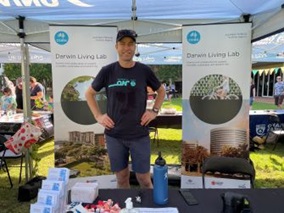
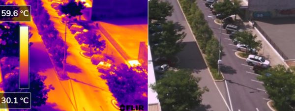
Recently our scientists were part of the STEAM Spectacular at Charles Darwin University in Darwin. More than 300 kids enjoyed the family fun day of science workshops and activities related to STEAM: science, technology, engineering, art and maths. The kids were able to use thermal cameras and micro-climate measurements to see how different surfaces retain heat and how shading and greening improves outdoor thermal comfort.
 " After="" />
Darwin has high energy use for cooling buildings which will only be exacerbated with climate change. This webinar will explore challenges and opportunities to reduce the energy and carbon footprint of cooling the built environment in Darwin. Join our free webinar this Thursday 4 Nov 2021 2:30 PM to 3:30 PM ACST (4 PM to 5 PM AEDT)
.ashx?as=1&h=279&la=en&w=600&hash=0306B441C02655FADD339CA545256476083E7519)
Outdoor workers are at greater risk than most people when it comes to extreme temperature and humidity. The current brutal heatwave in Darwin highlights the challenges for outdoor workers, particularly during the build-up. To find out how heat and humidity can affect the health of outdoor workers, the CSIRO Darwin Living Lab team is working with the University of Tasmania to trial the AirRater app. AirRater is a free smartphone app available to all Australians to help them track environmental hazards such as temperature and humidity, air quality and pollen (where available). More information on the study is available here or tune into the recent webinar. Are you an outdoor worker, or know someone who is?

The Darwin Digital Twin web-based tool is progressing, with digital aerial photography acquired for the ABS census years of 2011 and 2016. This data is currently being analysed by Data61 using their Urban Monitor methodology. Aerial photography for 2021 has recently been captured for the NT Government with arrangements in place for this data to be provided to CSIRO and added to the analysis. This will provide a current benchmark of green infrastructure assets (2021) and change over time from the baselines of 2011 and 2016. Integration of these data sets in the digital twin will support investment decisions in green infrastructure and implementation of the NT Heat Mitigation Strategy and City of Darwin’s Greening Strategy. Outputs will enable timely reporting on Darwin’s livability, sustainability, and resilience.
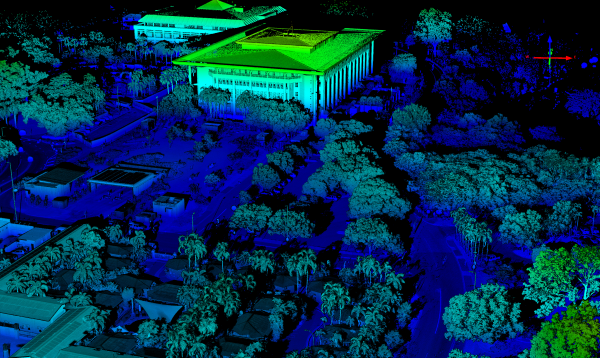
CSIRO scientists have also been undertaken LiDAR and thermal scanning from the 8th floor balcony of Manunda Place. The LiDAR data can measure the rates of tree growth and mortality, and to model the shading and cooling effects of green spaces on the urban environment. While the thermal imaging will help validate how the greening and reflective pavements are lowering surface temperatures in the city. Drone-based thermal imaging is planned for the later this year to monitor how the greening of Darwin is helping to cool the city.